
Southern California Storm Update: What to Expect and When
Winter Storm Brings Colder Temperatures and Snow to Southern California Mountains
Southern California is bracing for another round of winter weather as a new storm system approaches the region, promising colder temperatures and increased snowfall in the mountains.
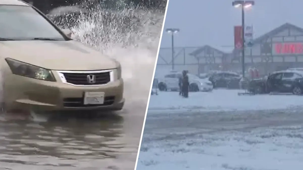
This week’s storm follows an already unsettled weather pattern, with meteorologists predicting a fresh influx of rain and snow starting tonight. The anticipated system is set to lower snow levels, particularly affecting areas like Big Bear Valley.
According to NBC Los Angeles meteorologist Belen De Leon, the rain will begin with intermittent showers throughout Tuesday, intensifying as the sun sets. The heaviest rainfall is expected overnight into Wednesday morning, prompting a Flood Watch in Ventura and Los Angeles counties as well as along the Malibu coast. Forecasters warn that heavy showers and possible thunderstorms could lead to flash flooding in these areas.
De Leon outlines the projected peak rainfall times as follows:
- Ventura County: 10 p.m. to 2 a.m.
- Los Angeles County: 11 p.m. to 2 a.m.
- Orange County: 1 a.m. to 3 a.m.
- Inland Empire: 1 a.m. to 4 a.m.
The storm is expected to deliver between 0.25 and 1 inch of rain to coastal and valley areas, while mountain regions could receive up to 2 inches. Additionally, this system will bring colder air, lowering snow levels to between 3,500 and 4,000 feet, which could enhance tourism in areas like Big Bear that recently welcomed its first snowfall of the season on February 16.
The National Weather Service has issued a Winter Storm Warning for the San Bernardino County mountains, which includes Big Bear Lake, Wrightwood, and Lake Arrowhead, effective until 10 p.m. Thursday. Travelers are advised to exercise caution, as the snowy conditions may create hazards on mountain passes, especially on the Grapevine.
Despite the challenges posed by flooding during Monday’s rain, the prospect of fresh snow is welcomed by local businesses in mountain communities that rely on winter tourism. As the storm progresses, travelers heading to the mountains should ensure their vehicles are equipped with chains.
The storm system is expected to wrap up by Wednesday morning, though residual flooding and slippery road conditions could linger. Heavy snowfall will persist in the mountains through Thursday, with additional accumulations projected:
- 1–4 inches from 3,500 to 4,500 feet
- 6–12 inches from 5,000 to 6,000 feet
- 12–18 inches above 6,000 feet
Some elevations over 6,000 feet may even see an additional 1–2 feet of snow.
As the storm subsides by Friday, Southern California is expected to experience partly cloudy skies and a warming trend heading into the weekend. However, meteorologist Melissa Magee warns that another storm could be on the horizon for the following week.


