
Rain Expected with Upcoming Cold Storm: Check Out the Timeline for Flood Risks
Heavy Rainfall Anticipated in Southern California
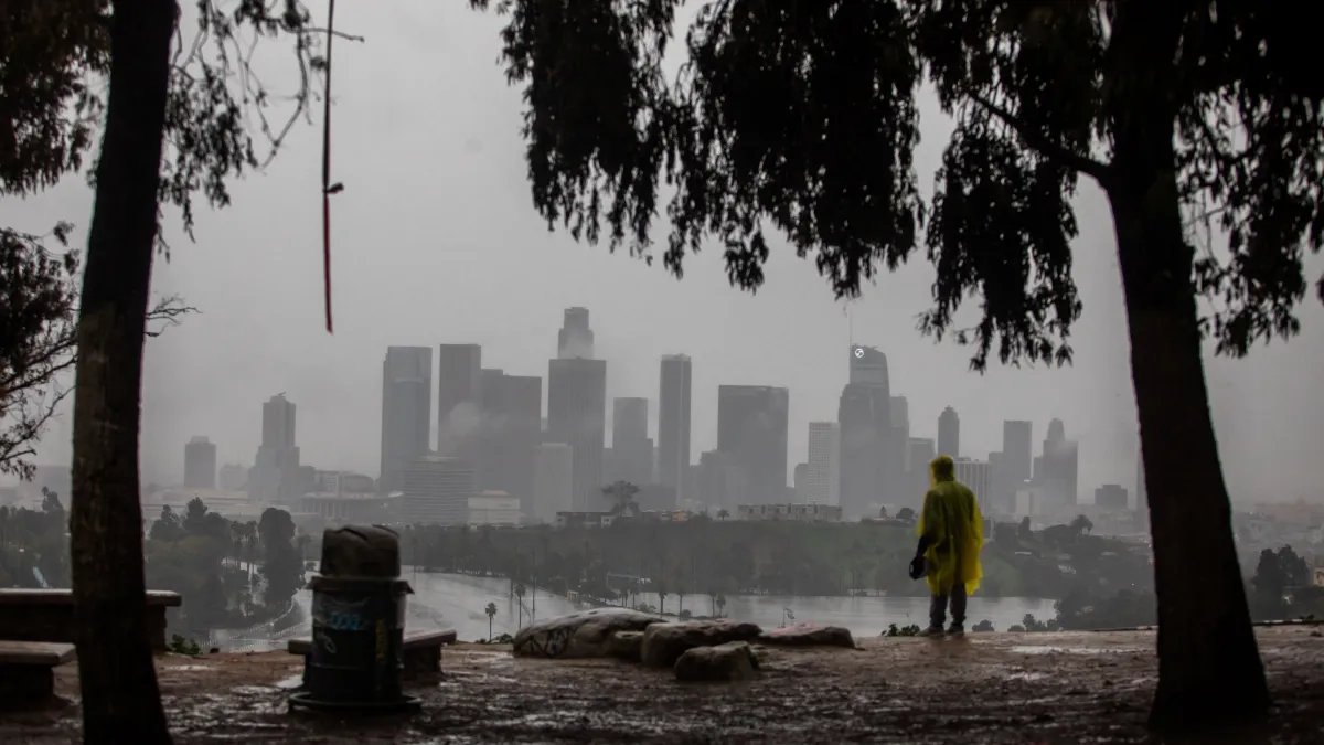
Southern California is bracing for significant rainfall as a cold front approaches, prompting flood watches and evacuation warnings across parts of Los Angeles County. As the storm system moves in, several days of wet weather are on the horizon.
Monday is expected to bear the brunt of this weather event, with early showers giving way to heavier rain throughout the afternoon. Meteorologists predict that coastal and valley areas could receive between 1 to 3 inches of rain, while mountain regions may see totals ranging from 2 to 5 inches by the end of the day.
A flood watch is in effect across much of Los Angeles County from Monday morning into the evening. The potential for rock and mudslides increases near steep terrains, and debris flows are likely in areas affected by recent wildfires. “On Monday, that’s going to be the most active day,” noted NBC4 meteorologist Stephanie Olmo.
Rainfall intensity is expected to ease on Monday night into Tuesday, although sporadic showers may continue as cooler air settles into the region. The forecast also includes strong winds, with the possibility of brief and weak tornadoes.
Snow levels are predicted to drop from approximately 6,500 feet at the onset of the storm to around 5,000 feet by Tuesday. A second storm system is projected to arrive Tuesday night into Wednesday, bringing colder temperatures and additional rain and mountain snow. Areas may receive another 1.5 to 3 inches of rain, with the mountains potentially accumulating 3 to 6 inches.
Temperatures will begin to decline on Monday, with daytime highs expected in the mid-50s and nighttime lows dipping into the 40s across most areas. In higher elevations, including the mountains and Santa Clarita Valley, lows could fall into the 30s from Tuesday through Friday.
As part of preparations, evacuation warnings have been issued for properties near recent wildfire burn areas. These warnings, effective from Sunday night through Tuesday morning, advise residents in the affected zones—including Canyon, Bethany, Eaton, Palisades, Kenneth, Sunset, Lidia, Hurst, Franklin, and Bridge fire areas—to be prepared for potential evacuation orders.
The National Weather Service has urged individuals living in vulnerable areas to take precautions now, highlighting the risks of severe weather that may include small tornadoes, winds reaching 60 mph, and rainfall rates of one inch per hour.
This forecast brings a serious reminder of the potential hazards associated with severe winter weather in the region.