
Midweek Weather Update: Expect Showers and Cooler Temperatures in Southern California
Weather Forecast for Southern California: March 30
A significant shift in weather patterns is anticipated in Southern California, coinciding with the Easter holiday weekend. As residents prepare for this transition, many will notice changes in precipitation and temperature across the Greater Los Angeles area, including beaches, valleys, and desert regions.
According to meteorological reports, a low-pressure system is expected to bring a 40% chance of widespread rain beginning Tuesday afternoon. Showers may disrupt evening and morning commutes on Tuesday and Wednesday, but rainfall amounts are projected to remain light, averaging around a tenth of an inch in most areas.
“This week, precipitation opportunities will begin Tuesday and continue into Thursday, specifically impacting commutes tomorrow afternoon and early Wednesday,” explained FOX 11 meteorologist Soumada Khan.
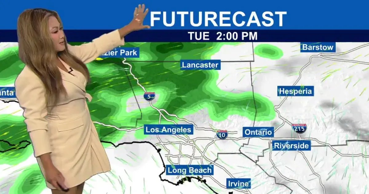
Timeline of Weather Changes
- Monday: Expect patchy morning fog to clear, giving way to partly sunny skies. Inland areas are forecasted to reach highs in the 80s, with valleys hitting 83 degrees.
- Tuesday Afternoon: Rain chances begin, likely affecting the afternoon commute.
- Wednesday Morning: Showers will likely continue, potentially impacting morning travel.
- Thursday: A 10% chance of lingering rain remains before the weather system dissipates.
Rainfall Projections
Forecast models indicate minimal rainfall for most regions. “Rainfall totals will be light, about a tenth of an inch, with perhaps slightly more for foothills and mountain communities,” Khan noted.
Outlook
As the midweek storm subsides, a notable warm-up is anticipated in time for Easter weekend, offering a stark contrast to the recent cool and wet conditions.